Feedback
Welches Thema möchten Sie ansprechen?
- Allgemein
- Website
- Radroutenplaner
- Bayernnetz für Radler
- Radverkehr
- iOS-App
- Android-App

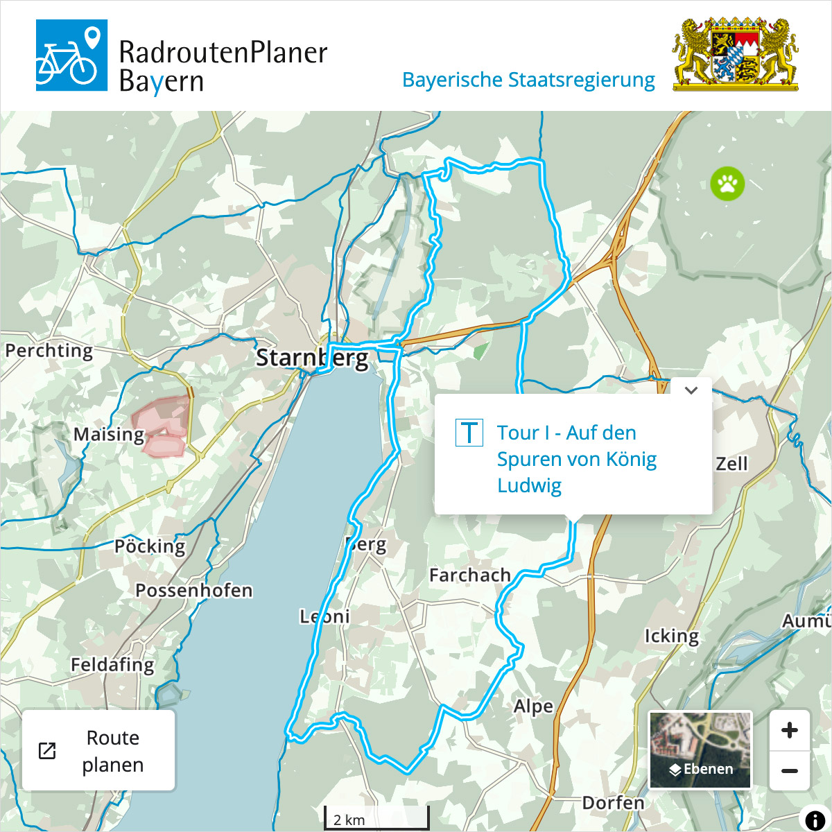
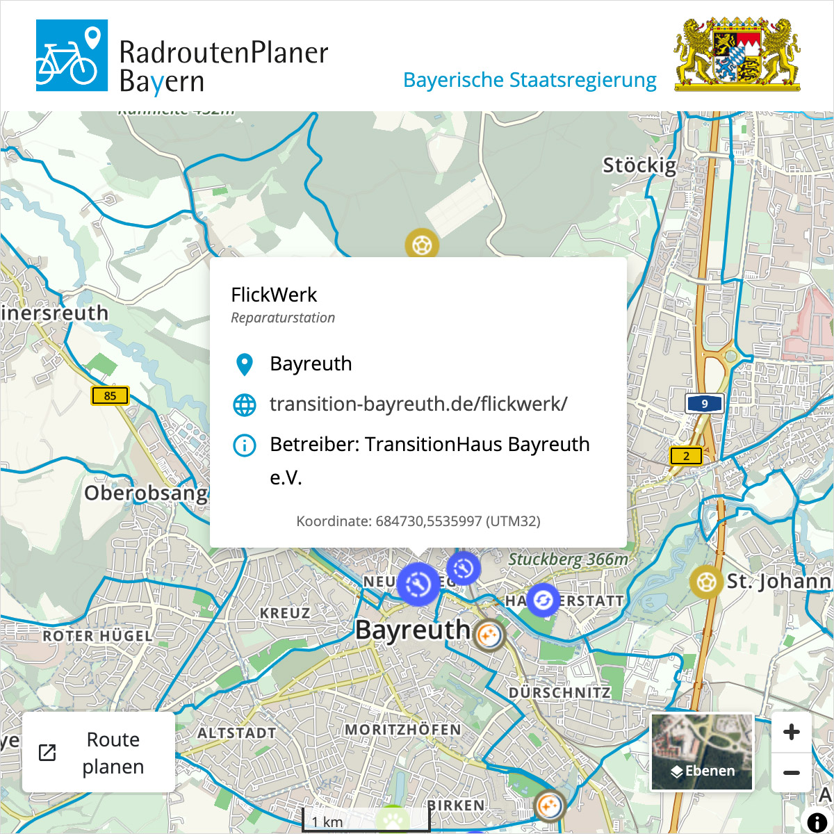
Provide your website visitors with a cycling map for your region. RadlLand Bayern offers a cycling map as an iFrame that you can embed directly on your website. The cycling map provides an overview of the cycling network in your region. The routes, shown in blue, are interactive and can access further information, such as details on specific thematic routes. Optionally, official road closures and information on points of interest (POIs) can be displayed.
Configure your RadlLand Bayern map in 4 steps:
1. Specify the width and height of the map window
2. Select map content to display points of interest (POIs) and road closures on the map
3. Define the map area by panning and zooming
4. Copy the code to implement it on your website
1. Fenstergröße
Wählen Sie die Größe des iFrames.
2. Karteninhalte
Wählen Sie Karteninhalte, um wichtige Punkte (POI) und Sperrungen auf der Karte anzuzeigen.
3. iFrame Vorschau
Bestimmen Sie durch Verschieben und Zoomen den Kartenausschnitt.
Mit “Ausschnitt bestätigen” wird der iFrame-Code erzeugt.
4. Code kopieren und in Ihre Website einfügen
Hinweis: In ihrem Karten-iFrame wird die Schaltfläche „Ausschnitt bestätigen” durch „Route planen” ersetzt.
Ein Klick genügt – und der Radroutenplaner Bayern öffnet sich in einem neuen Browser-Tab. Dabei wird die gewählte Kartenposition als Ausgangspunkt verwendet, sodass Ihre Nutzer schnell und unkompliziert individuelle Radrouten in ganz Bayern planen können.
Make every kilometer of cycling route in your region visible with our map iFrame!
With the map iFrame, you can provide your users with important information for cyclists in your area.
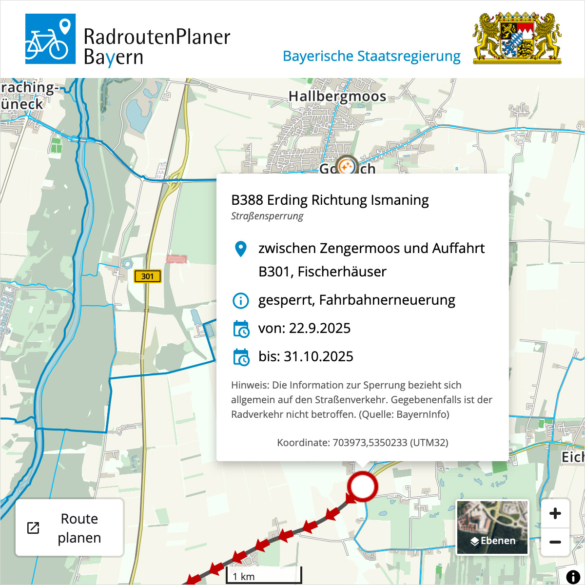
Inform users about important road closures in your area to help ensure everyone’s safety.
Legal Notice
By embedding the map iFrame into your website, you agree to our terms of use and privacy policy.
Technical Notes
The display on your website depends, among other things, on the selected view port and other display parameters of your website’s content management system, which may influence or override the parameters of the code snippet. If you have any questions or problems, please feel free to contact us at any time via the Feedback form.

